By Dr. Shawn Clem, Director of Audubon's Western Everglades Research Center
Fifty-eight years ago on September 10, 1960, Hurricane Donna made landfall south of Naples, Florida as a category 4 storm, its eye passing a few miles west of Audubon’s Corkscrew Swamp Sanctuary. Last year on September 10, 2017, Hurricane Irma arrived as a category 3 storm, its landfall and track through Southwest Florida eerily similar to that of Hurricane Donna. Long-term monitoring data collected by Audubon staff from these two storms demonstrate how similar these two storms really were and support recent research that detected a troubling loss of water from the swamp.
Hurricane Donna brought 5.6 inches of rainfall to Corkscrew, raising water levels at the ‘B’ staff gauge (in our north Lettuce Lake) to 4.33 feet. Donna’s high water mark has only been surpassed only twice in our 61-year continuous hydrologic record – in August and then October of 1995 when Tropical Storm Jerry and Hurricane Opal delivered a one-two punch of tropical weather to Southwest Florida.
Last year, Hurricane Irma dropped 12.6 inches of rainfall in the sanctuary which brought water levels to 4.17 feet, our fourth-highest water level on record. Interestingly, in the wet season leading up to the September 10 storms we received nearly twice as much rain in 2017 than we did in 1960 (June-August 1960 rain = 30.6 inches, June-August 2017 rain = 59.0 inches). So despite record-breaking rainfall in the summer of 2017, maximum water levels recorded at Corkscrew Swamp Sanctuary following Hurricane Irma were within a few centimeters of the peak water levels following Hurricane Opal, Tropical Storm Jerry, and Hurricane Donna. Audubon scientists hypothesize that this peak represents the maximum water storage capacity of the swamp. In other words, if you picture the swamp like a bowl, this is the point where the bowl is full and any additional water spills across the regional landscape and cannot be held by the swamp.

In the two to three months following Hurricanes Donna and Irma, water levels in Corkscrew’s Lettuce Lakes receded quite similarly. After January 1, however, big differences become apparent. This past year, in the dry season that followed Hurricane Irma, water levels fell much faster and the water table dipped much lower than we saw after Hurricane Donna. This perceived “drier dry season” in early 2018 was despite record-breaking wet season rainfall and despite relatively typical monthly dry season rainfall.
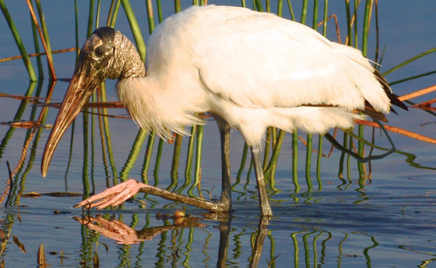
So where did our water go? This is a question that has been troubling our research staff since we first detected this annual over-drying trend several years ago (see our Research Report for more details). Our data analyses suggest that regardless of wet season conditions, since 2000 we have dried down faster and stayed dry for longer than we ever did historically. This hydrologic change has tremendous implications for our plants and wildlife (including Corkscrew's iconic Wood Storks), the integrity of our natural habitats, and even Corkscrew’s risk for devastating wildfires. Our team believes the change may be due to some combination of land cover changes, ground water withdrawals, and water management practices, but more research and modeling are needed. We continue to utilize long-term monitoring as a tool for understanding change in our ecosystem, exploring options for further analyses to elucidate hydrologic changes and understand implications, and working with our policy team to ensure we’re doing everything we can to protect this extraordinary ecosystem.